
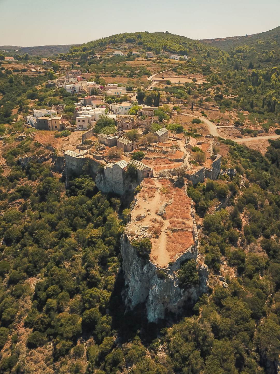
In a country with so many hidden and unexplored corners, the little-known hiking trails of Greece are a magical treat for anyone who loves walking and nature. There are fantastic trails on both mainland and islands, following mountain or coastal routes (and sometimes both). You can enjoy them all year round, especially in spring and autumn when nature is at its best and conditions are ideal for walking. Some follow ancient pathways or old shepherd’s trails, and others join remote villages, taking you to epic viewpoints, remote coves and hidden waterfalls.
So here they are… our selection of the best unknown hikes for your holidays in Greece.
For tips while hiking in Greece and other useful information, see the Tips for hiking in Greece section below
The article introduces 12 of Greece’s best lesser-known hiking trails, spanning both mainland and islands, ideal for walkers seeking authentic nature and culture. Each trail offers unique highlights, such as waterfalls in Kythira, ancient monasteries in Skiathos and Hydra, vineyard paths in Samos, and wild landscapes in Kasos and Crete. Most routes are best enjoyed in spring or autumn and range from easy walks to more demanding hikes, often linking remote villages, archaeological sites, or dramatic viewpoints. Essential hiking tips include staying hydrated, checking the weather, and using marked trails or guides for safety.
The article introduces 12 of Greece’s best lesser-known hiking trails, spanning both mainland and islands, ideal for walkers seeking authentic nature and culture. Each trail offers unique highlights, such as waterfalls in Kythira, ancient monasteries in Skiathos and Hydra, vineyard paths in Samos, and wild landscapes in Kasos and Crete. Most routes are best enjoyed in spring or autumn and range from easy walks to more demanding hikes, often linking remote villages, archaeological sites, or dramatic viewpoints. Essential hiking tips include staying hydrated, checking the weather, and using marked trails or guides for safety.
- The roads of Kastro
- The valley of the watermills
- The path of the marble villages
- The Tinos’ Trails
- The trail of healing
- The best of Sifnos in a single hike
- The paths of peace
- The hiking trails of wild Kasos
- The trail of the shepherd’s huts in the White Mountains
- The hiking path of eastern Hydra
- The archaeological walk of northern Ithaca
- Ithaca Trails (Path 14)
- The path of vineyards in Samos
- The trail from Agios Ioannis in Sfakia
- Tips for hiking in Greece
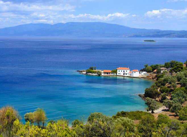
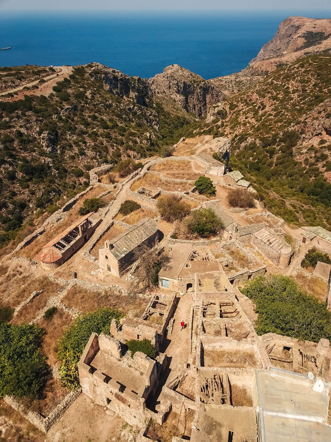
The roads of Kastro
Skiathos
This circular route No.6 presents a special side of Skiathos, far from the settlements. It passes by olive groves, oak and holly trees, monasteries and chapels, watermills, threshing floors and springs, relics, cobblestone paths and beaches. So much that is characteristic of Skiathos in a single hike. For this reason, it is presented as the “fullest” of the network of hiking paths in the Skiathos Trails. All the highlights of this walk represent the quickest and most beautiful way of getting to know Skiathos – including the culture and history of the island. Two of the island’s most important cultural spots … Kastro (built in 1360) and the Monastery of Evangelistria (under its tallest peak, Mt Karaflitzanaka) are joined by this fantastic route. The monastery is famous for being the site where, in 1807, the first Greek flag (with a white cross in the middle of a blue background) was designed, blessed and raised.
- Start & end point: Aesthetic Forest of Skiathos
- Walking time: 4hr50min
- Length: 11km
- Difficulty: 3/5
- Where to stay: Anywhere in Skiathos
- More info here
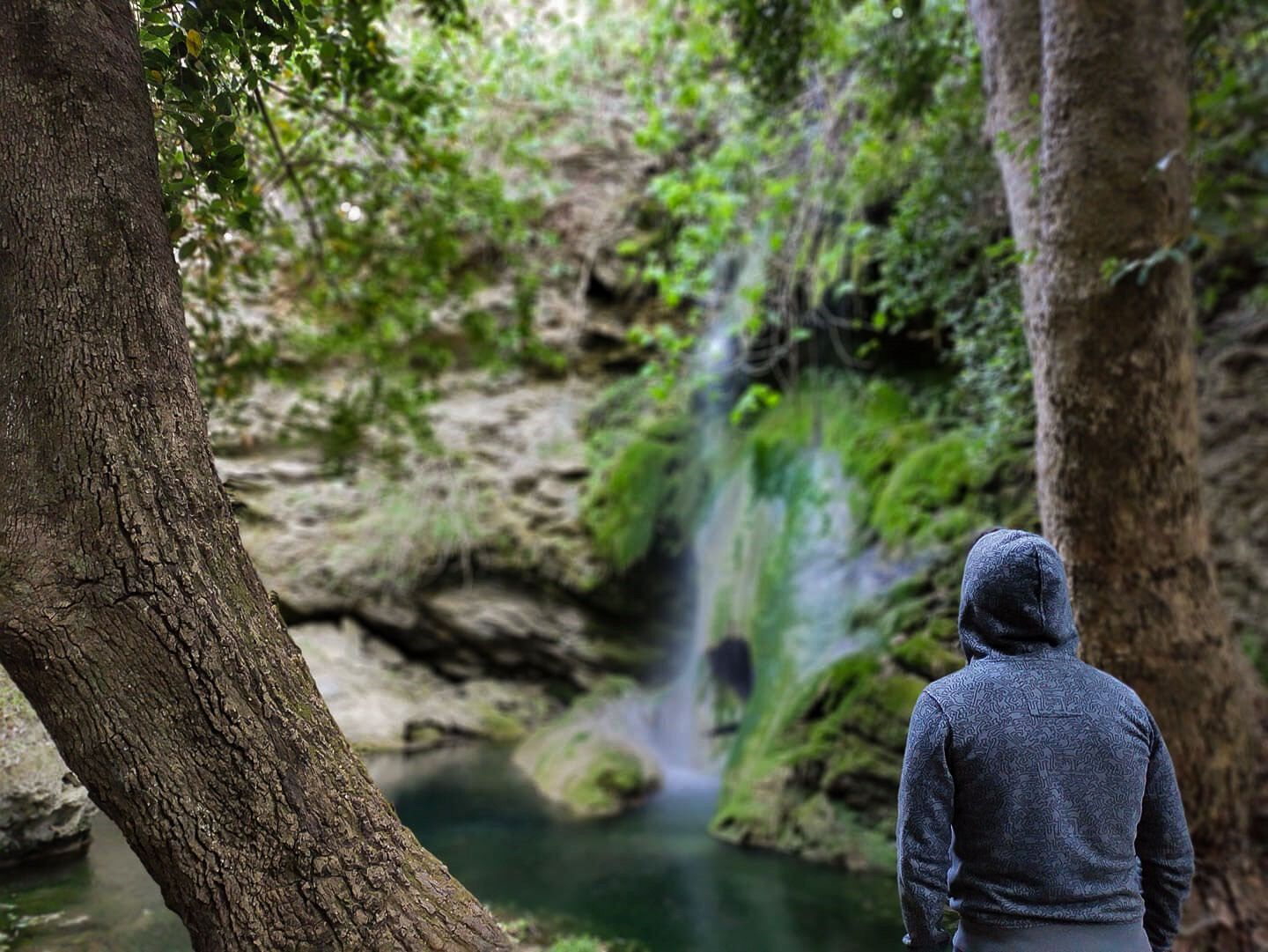
The valley of the watermills
Kythira
This captivating circular route (Kythera trails, route M41) on the island of Kythira reveals a hidden world of waterfalls, plunge pools, huge plane trees, maple trees, stone bridges, water mills, little churches and a Venetian castle that seems untouched by time. The hike starts from the traditional village of Mylopotamos, descending to a series of waterfalls and 23 watermills. It ends at the spectacular Castle of Kato Hora, where the winged lion of Saint Mark still stands proudly at the gate.
- Start & end point: Mylopotamos
- Walking time: 2hr30min
- Length: 4.8km
- Difficulty: 2/5
- Where to stay: Anywhere in Kythira
- More info here
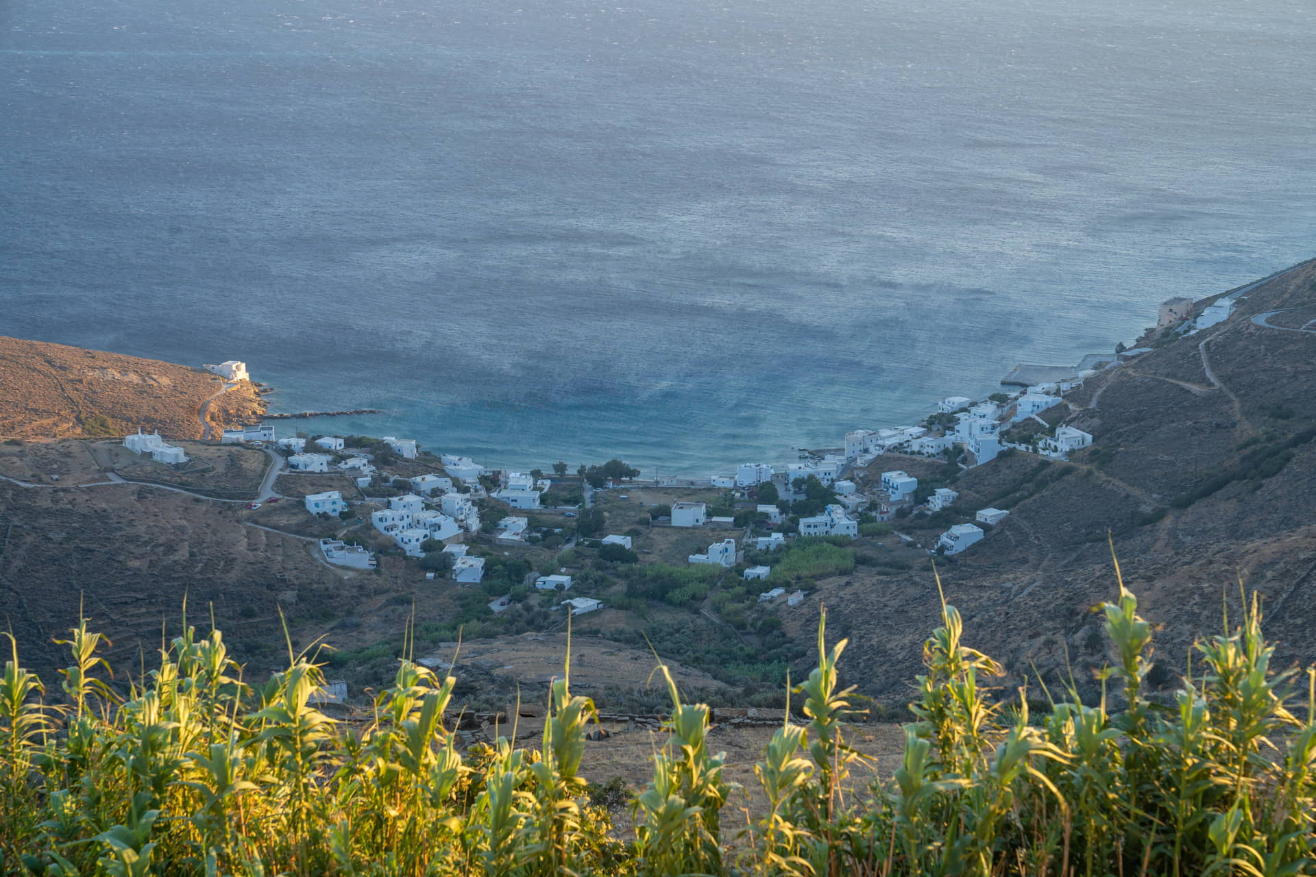
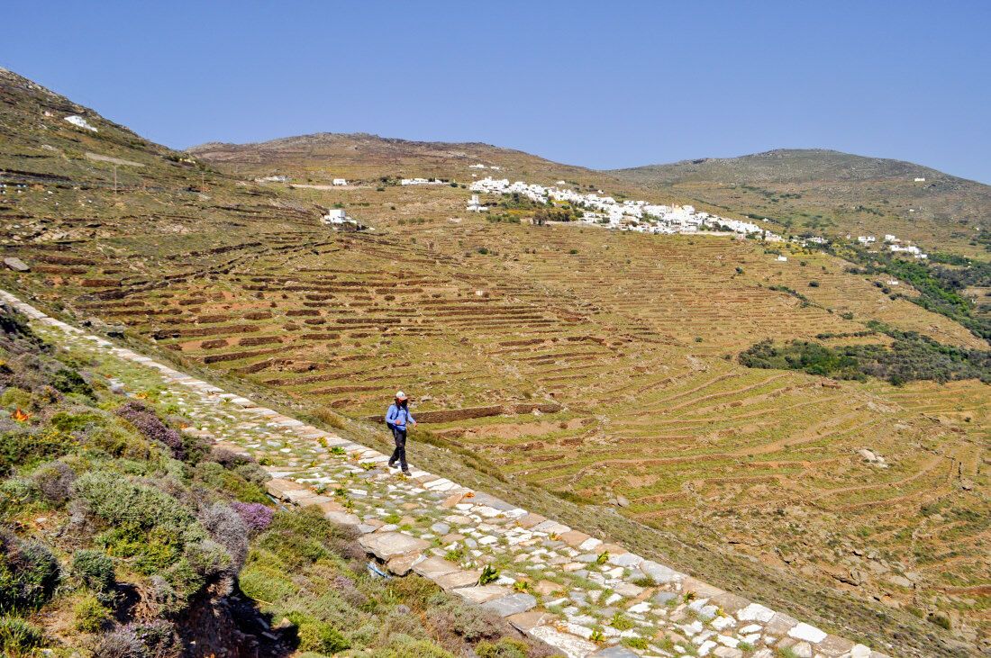
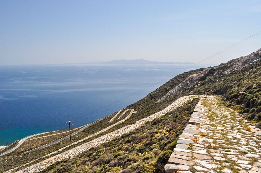
The path of the marble villages
Tinos
A memorable circular route that takes you through picturesque villages and along the green slopes of Tinos. The trail (Tinos Trails' Route E1) is straightforward, setting out from Giannaki Bay in the direction of Kardiani, overlooking the Aegean. It continues towards Old Kardiani, accompanied by views of the island’s rocky landscape and the scent of wild herbs. Arriving at vibrant Ysternia, a stop for a coffee or refreshment is a must. From here, there is a flat, marble-paved path that ends at Ysternia Bay that is worth taking. And from Ysternia Bay, there is an old footpath that crosses impressive terraces and passes Panagia tis Lakotianis church, taking you past dovecotes and the threshing floors of Stasi, before returning to Giannaki Bay.
- Start & end point: Giannaki Bay
- Walking time: 5hr30min
- Length: 14.2km
- Difficulty: 3/5
- Where to stay: Anywhere in Tinos
- More info here
The Tinos’ Trails
The trail of healing
Abeliona, Messinia (Peloponnese)
The trail of Therapeias (or healing) connects the beautiful village of Abeliona in Messinia (in the southern Peloponnese) with the UNESCO-protected Temple of Apollo Epicurius in Bassae, dedicated to the god of light, music, harmony and order in the world. The route climbs through a dense chestnut forest with centuries-old trees that offer shade and a magnificent view of the Lykeo and Tetrazi mountains. Continuing towards the village of Sklirou, the path crosses a small plateau with countless boulders, large stone threshing floors and derelict huts that bear witness to the hard lives of the inhabitants of old. A wide (possibly ancient) footpath heads out from Sklirou, ending at the temple of Apollo Epicurius. Many of the other hiking trails in the region are also suitable for mountain bikes.
- Start point: Abeliona (To Magazaki tou Spyrou taverna)
- End point: Temple of Apollo Epicurius
- Walking time: 3hr15min
- Length: 7.7km
- Difficulty: 3/5
- Where to stay: Villages close to the trail (eg Abeliona, Andritsaina, Karitaina, Stemnitsa)
- More info here
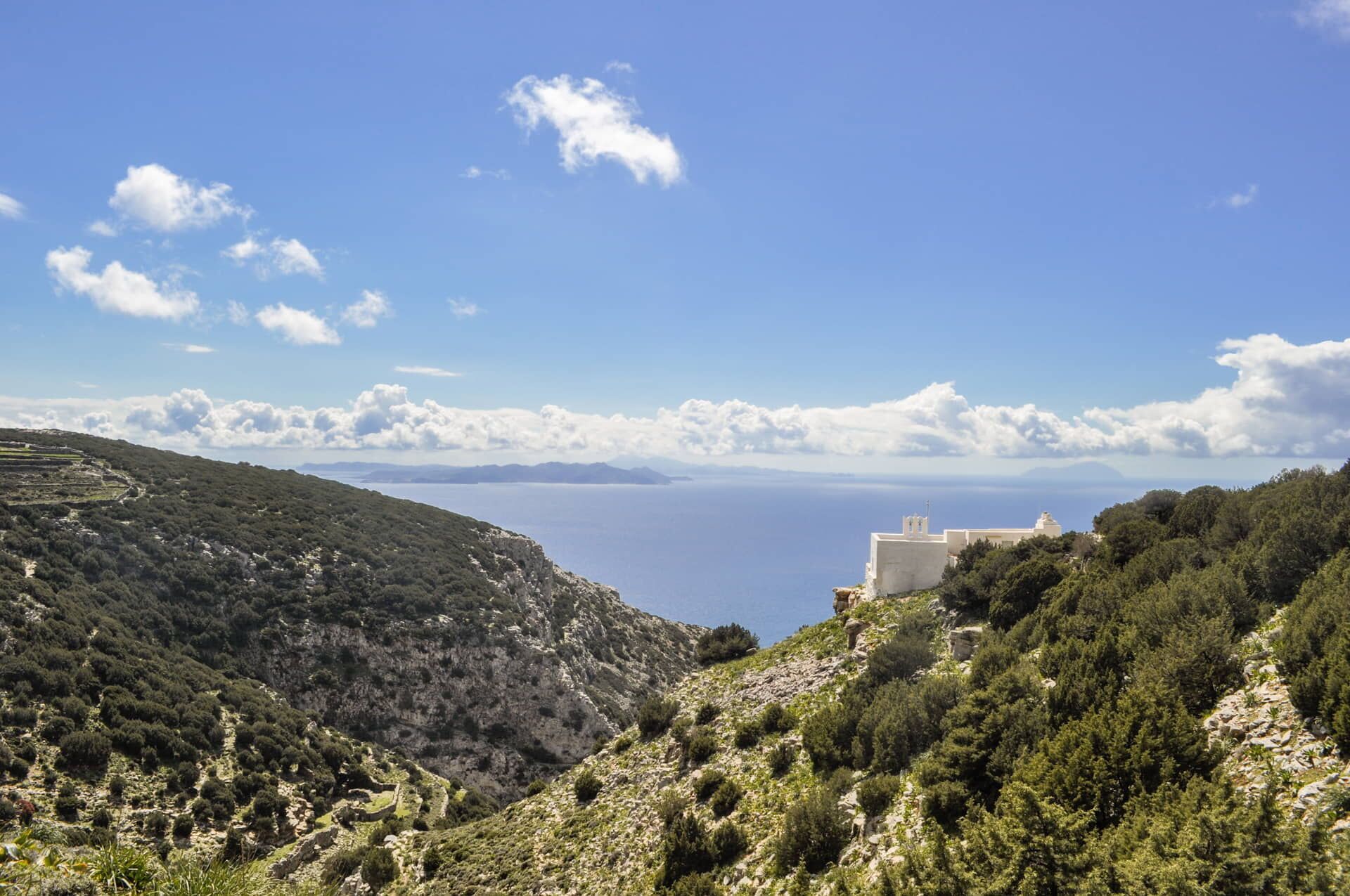
The best of Sifnos in a single hike
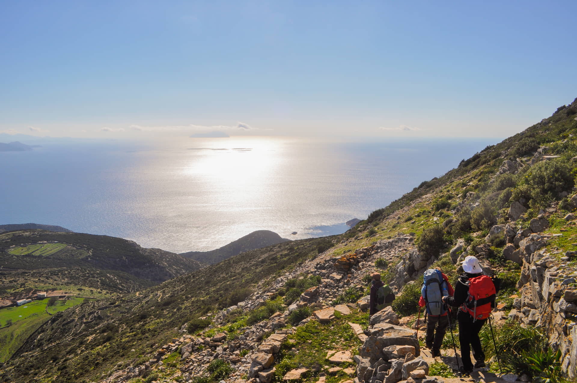
Sifnos
If you want to discover the untouched Cycladic landscape, the circular hiking path around Sifnos (Sifnos Trails Route No.6) is ideal. The route has cultural and natural highlights, including settlements, rural landscapes, little churches, cedar forests and mountain passes that overlook other Cyclades islands in the Aegean. The changing scenery is particularly striking, alternating from cultivated countryside to wild and rugged green hillsides. The path leads you up to the church of Panagia Toso Nero, at the most remote part of the island. It is said that the church was built to tame the area. You can rest in the hospitality of one of the monastic cells, as the path from here is uphill and challenging … although if you do continue, you’ll be rewarded with outstanding views. It’s a footpath that allows you to unlock virtually all the secrets of this beautiful island, which is rightly referred to as containing some of the best hiking trails in Greece!
- Start & end point: Apollonia (main square)
- Walking time: 7hr
- Length: 15km
- Difficulty: 3/5
- Where to stay: Anywhere in Sifnos
- More info here
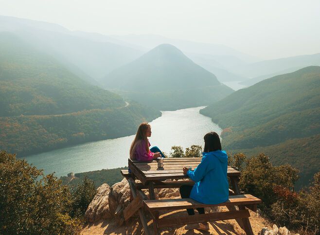
The paths of peace
Florina
A truly unknown Greece is discovered through Florina’s Paths of Peace, which lets you enjoy the best of northern Greece’s endless forests, greenery, lakes and mountains. The paths are made up of four connected routes around the city of Florina, joining the villages of Lehovo, Asprogia, Nymfaio, Sklithro and Limnohori. The area has a long and heavy history (with villages that have witnessed wartime atrocities and Civil War clashes and including the nearby lignite mines of Ptolemaida) so the name – the Paths of Peace – is designed to emphasise hope through nature. After all, nature here is of incomparable beauty, with a constantly changing landscape and the bonus of the Arcturos wolf and the bear sanctuary that is worth visiting near Nymfaio. It’s another of the least-known and most memorable hiking trails in Greece.
- Start & end point: Any of Sklithro, Nymfaio, Lehovo, Limnohori village
- Walking time: Total for all 4 routes: 14hr35min
- Length: 37.8km
- Difficulty: 2/5 και 3/5
- Where to stay: Any of the villages featured as well as Kastoria and Florina
- More info here
Photo credit: Paths of Greece
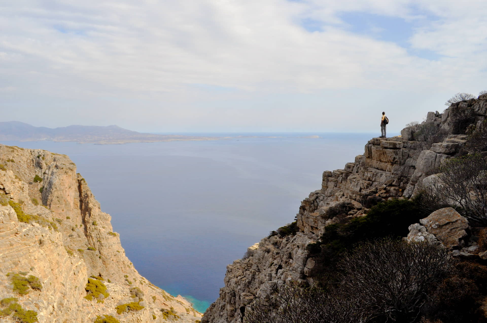
The hiking trails of wild Kasos
Kasos
On one of the most remote and authentic islands in Greece, Route 6 of the Kasos Trails network takes you through virtually inaccessible but wildly impressive parts of Kasos. It is a unique trail, passing old cultivation sites and shepherd’s huts (mitata), and an incredible range of views: a gorge reminiscent of the Grand Canyon (in the dimensions of Kasos, of course), the isolated beach of Tripiti (with its characteristic natural arch), cliffs, caves and ravines, and of course endless views the deep blue of the Aegean sea. Approaching the end of the path, a little before the settlement of Agia Marina, you reach the impressive Ellinokamara Cave, which was inhabited in ancient times. Kasos isn’t an easy island to get to, but the experience when you’re there (musical traditions, food and welcoming locals) is so intense that you won’t want to leave.
- Start point: Agios Georgos (Chadies)
- End point: Agia Marina (Kathistres)
- Walking time: 3hr10min
- Length: 8.6km
- Difficulty: 2/5 to Tripiti beach and 4/5 to Agia Marina
- Where to stay: Anywhere in Kasos
- More info here
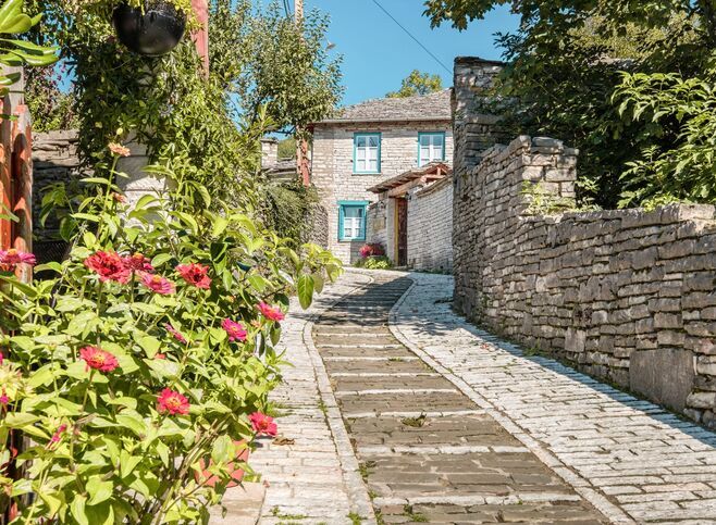
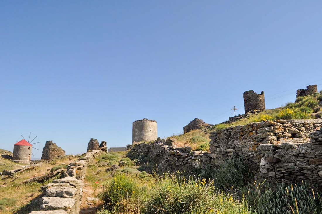
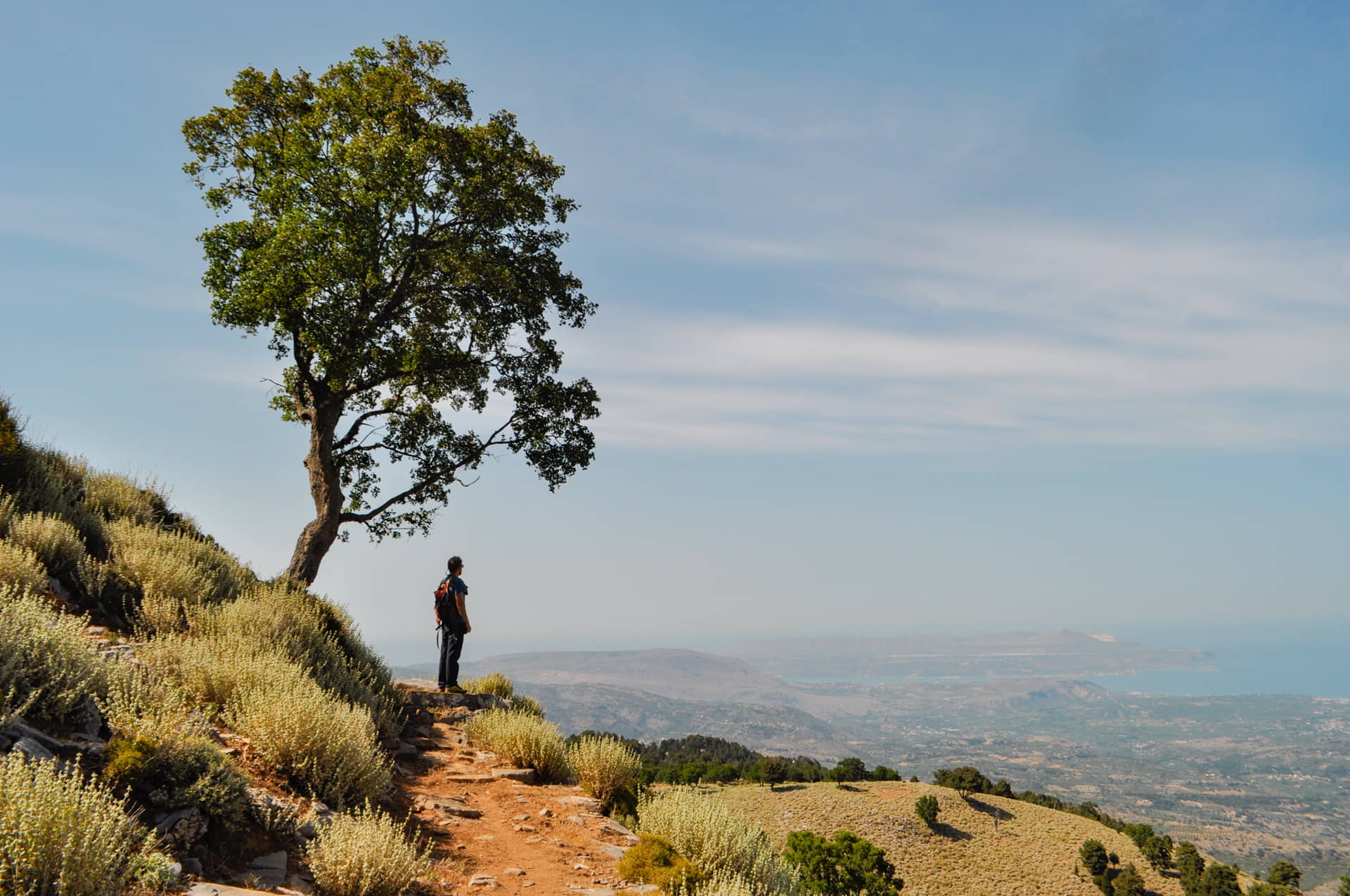
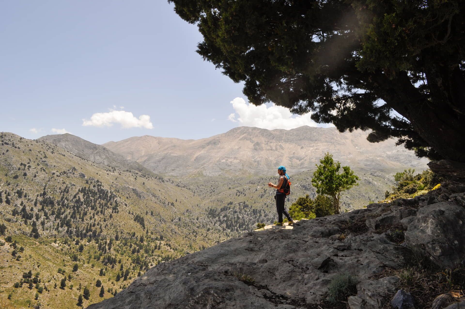
The trail of the shepherd’s huts in the White Mountains
Crete
Amongst the network of hiking paths of the Apokoronas villages (Apokoronas Trails) in Crete’s Chania region, Route No.3 stands out. It’s a circular route, starting at around 700m altitude near the village of Melidoni (which you can reach by car) and connecting three churches (Agio Pnevma Fre, Agio Pnevma Pemonion, Profitis Ilias Melidoniou) and natural water sources (Platanaki, Choses) on a route made up exclusively of little used old donkey trails or footpaths. The views alternate along the hike and take you past impressive mitata (or koumi), the traditional stone shepherd’s shelters that are a feature of Chania’s White Mountains). In this way, it’s a hiking path that allows you to experience both the natural and cultural landscape of Crete’s biggest mountain range without big height differences during the hike.
- Start & end point: A few kilometres outside Melidoni village
- Walking time: 7hr
- Length: 10.6km
- Difficulty: 4/5
- Where to stay: Melidoni (or any other Apokoronas village)
- More info here
The hiking path of eastern Hydra
Hydra
Starting at the port of Hydra, this hike (Hydra Trails, Route No.3) takes you past impressive monasteries (such as the Monastery of Agia Fotini and Elizabeth) before the landscape becomes wilder and drier as you reach the little Church of Profitis Elias. The rocky landscape (dotted with little chapels) contrasts with the blue of the sea and the imposing Panagia Zourva Monastery. From here, a stone-paved footpath of around 650 steps descends to Ledezas Bay which, according to the monks in the monastery, was built by a single person over 19 years. It is also worth visiting the Zourvas Lighthouse at the easternmost edge of the island. From here, you can return to Hora (Hydra’s main town) by taxi boat (when the sea is calm) or by taxi overland. Or if you prefer, you can start at the lighthouse and end in Hora.
- Start & end point: Hydra (Hora), Zourvas Lighthouse or Ledeza Bay
- Walking time: 6hr
- Length: 12.4km
- Difficulty: 3/5
- Where to stay: Anywhere in Hydra
- More info here
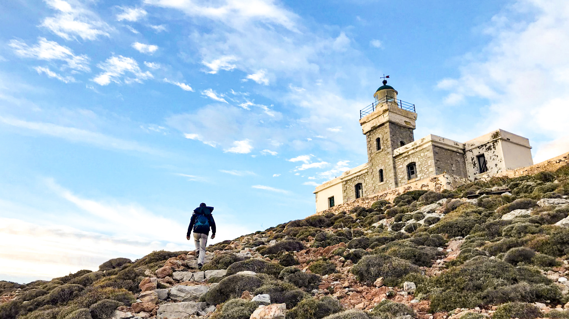
Photo credit: Paths of Greece
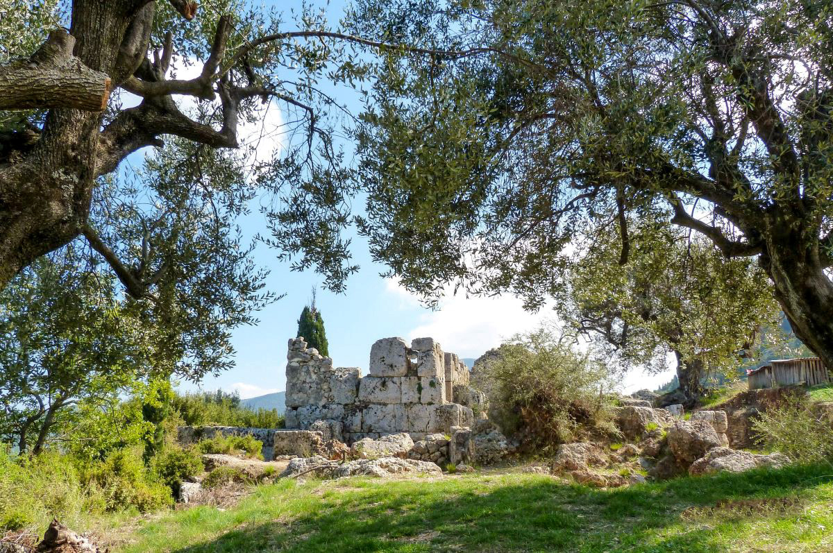
The archaeological walk of northern Ithaca
Ithaca
One of the Ithaca Trails (Path 14), the ‘Archaeological walk of northern Ithaca’ is a circular route that sets out from either Stavros or Exogi and includes two alternative stretches, 14A (connecting Exogi with Stavros via Pernarakia) and 14Β (linking Exogi with Rousano), returning on the same path. Path 14 is considered one of the island’s iconic trails, passing through the North Ithaca Basin and ending at the Roussano Plateau. If you hike the full distance, the mountain views and changing landscape are out of this world. You’ll also pass some of the most famous archaeological sites in Ithaca (the island famous as the home destination of Homer’s Odysseus), including the Archaeological Collection of Stavros above the Gulf of Polis, containing the Cave of Loizos, in which a fragment of a 2nd-century BC clay mask marked with ‘Efchin Odyssei’ (With the Blessing of Odysseus) was found. Meanwhile, at Agios Athanasios, beneath the village of Exogi, lies Homer’s School, the most important archaeological site on Ithaca.
- Start & end point: Stavros or Exogi
- Walking time: 3hr50min
- Length: 11.1km
- Difficulty: 3/5
- Where to stay: Anywhere in Ithaca
- More info here
Ithaca Trails (Path 14)
The path of vineyards in Samos
Samos
A wonderful circular route that celebrates the vineyards of Samos that produce the Muscat grape from which the island’s world-famous dessert wines are made. Heading out from the 16th-century village of Vourliotes, you walk along the slopes of Mount Karvounis, past countless vineyards, springs and ravines and the Monastery of Panagias Vrontas (believed to be the oldest in Samos). There are signs along the path with information about the nature, mythology, culture and agricultural traditions of the area. The viewpoints are amazing, allowing you to enjoy the changing scenery of the route, which can be walked all year round. Finally, if you’ve been introduced to the Greek spirit, Metaxa, you’ll be interested to learn that this is where it’s made.
- Start & end point: Vourliotes
- Walking time: 4hr
- Length: 9.7km
- Difficulty: 3/5
- Where to stay: Anywhere in Samos
- Good to know: You can reach Vourliotes by car or public bus (KTEL)
- More info here
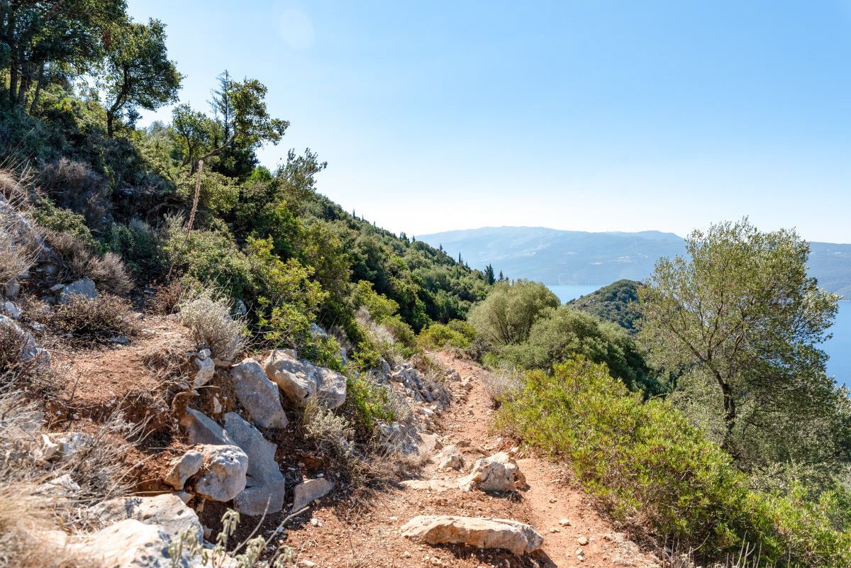
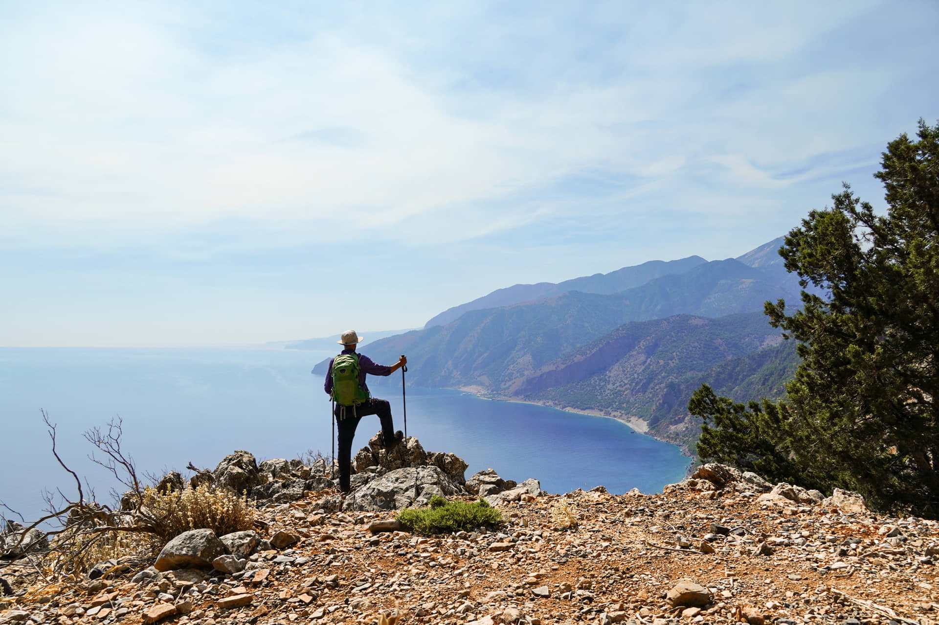
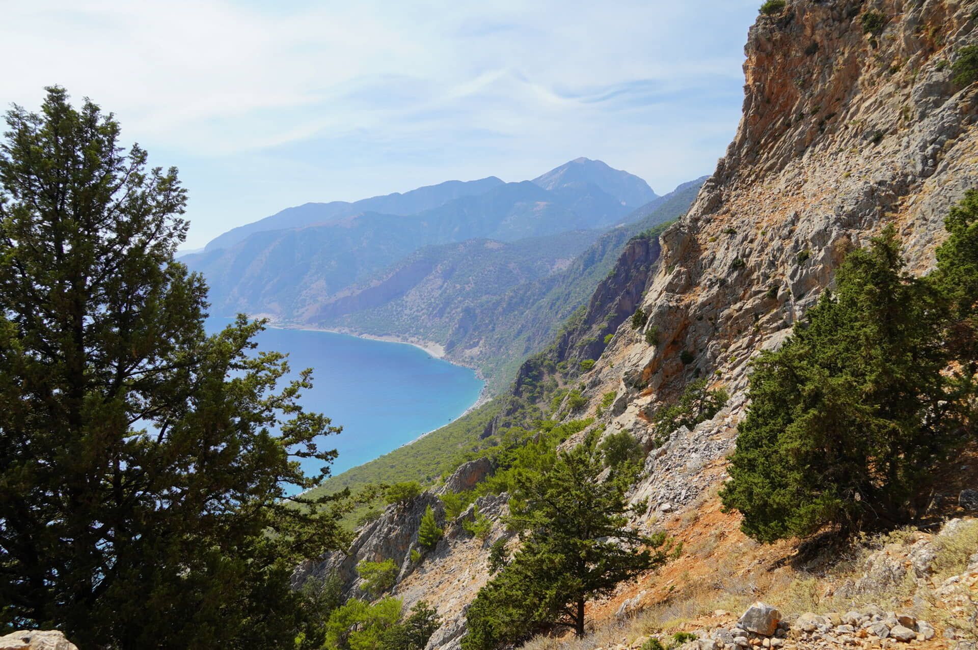
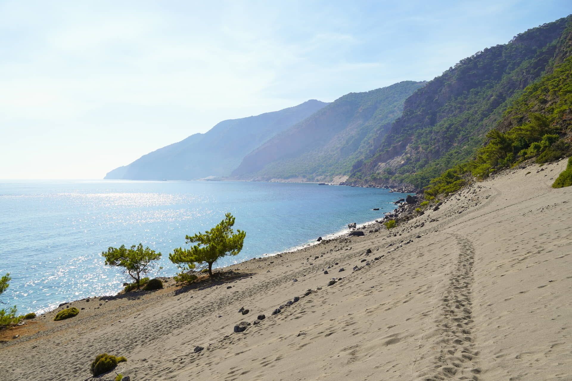
The trail from Agios Ioannis in Sfakia
Crete
A hiking path that sets out from the settlement of Agios Ioannis in Sfakia, at an altitude of 780m in the foothills of Chania’s White Mountains. It follows the rocky landscape from Koutelo tis Seloudas (also known as the Balcony of Sfakia because of its impressive views of the Libyan Sea and the Bay of Agia Roumeli). From here, it joins a section of the Ε4 long-distance European hiking trail, passing through a thick pine forest in the direction of Agios Pavlos (with its distinctive church and wonderful water). The final leg of the hike is along the coast towards Agia Roumeli (the end-point of the Samaria Gorge, another one of the best hikes in Greece).
- Start point: Agios Ioannis, Sfakia
- End point: Agia Roumeli
- Walking time: 5hr
- Length: 10.2km
- Difficulty: 3/5
- Where to stay: Agios Ioannis or anywhere in southern Chania
- More info here
Tips for hiking in Greece
Hiking is a magical way to enjoy the Greek countryside but make sure to be prepared and protect yourself, especially on very hot days.
- Stay hydrated: Always wear a hat and carry plenty of water with you
- Be weather-wise: Check the weather forecast before setting out. Avoid hiking during the midday heat and extremely hot periods. The best periods for hiking in Greece are during the spring and autumn months
- Plan your walk: Whenever possible, follow marked trails and plan your walk. Ideally, use a guide and never hike alone. Ask for directions if you’re unsure. This helps protect both you and the natural environment
- Stay connected: Have the phone numbers of your hotel and local authorities handy. And make sure your mobile phone is fully charged. The European emergency number 112 is available 24/7, connecting you to local police, fire and ambulance services.
After Best of Title
12 of the best unknown hiking trails in Greece
Around 80% of Greece is covered in mountains and there are so many islands to choose from. So it’s not surprising that it’s a paradise for hikers, especially when you’ve been introduced to the hidden trails all over the country.
Discover Greece Your Way
Discover authentic local experiences and secure your bookings for activities and tours with our official online rates.
Anamar Skiathos Hotel
Skiathos Villa Jasmin
Princess Resort Skiathos
Bill & John Skiathos
Villa Nefeli Skiathos
Radisson Resort Plaza Skiathos
Ferries to & from Skiathos
Find routes, ports & schedules - search below